lundi 10 février 2014

Mt Gulugod Baboy (+525m) hegymásszás - Trek to the Mt Gulugod Baboy

2014 február 02 :  Míg a banda egy része, Thomas és Tibor, még egy utolsót merültek (6. merülés 2 nap alatt), Zoé, Joan és Martine lustálkodtak (jól megérdemelték) , mi, (Fanny, Jean, Christophe és én), elhatároztuk hogy "megmásszuk" a hotel mögötti "hegyet". Bár hegynek van el nevezve : Mt Gulugod Baboy (Tagaloggul : a "disznó gerince") , ez igazán csak egy 525 méteres magas dombocska.
Egy helyi hegymászó jött velünk, nehogy elvesszünk az egyetlen földi úton amely felvitt a tetejére. Indulás előtt regisztrálni kellett nevünket és indulásunk időpontját, majd ha nem jöttünk volna vissza estére, küldték volna a mentőket....
Meg kell mondanom hogy szépen megizzattunk az 1 órás fel sétálásban és voltak könnyebb és nehezebb szakaszok. Találkoztunk helyi lakóssal és egy szimpatikus tehénnel is.
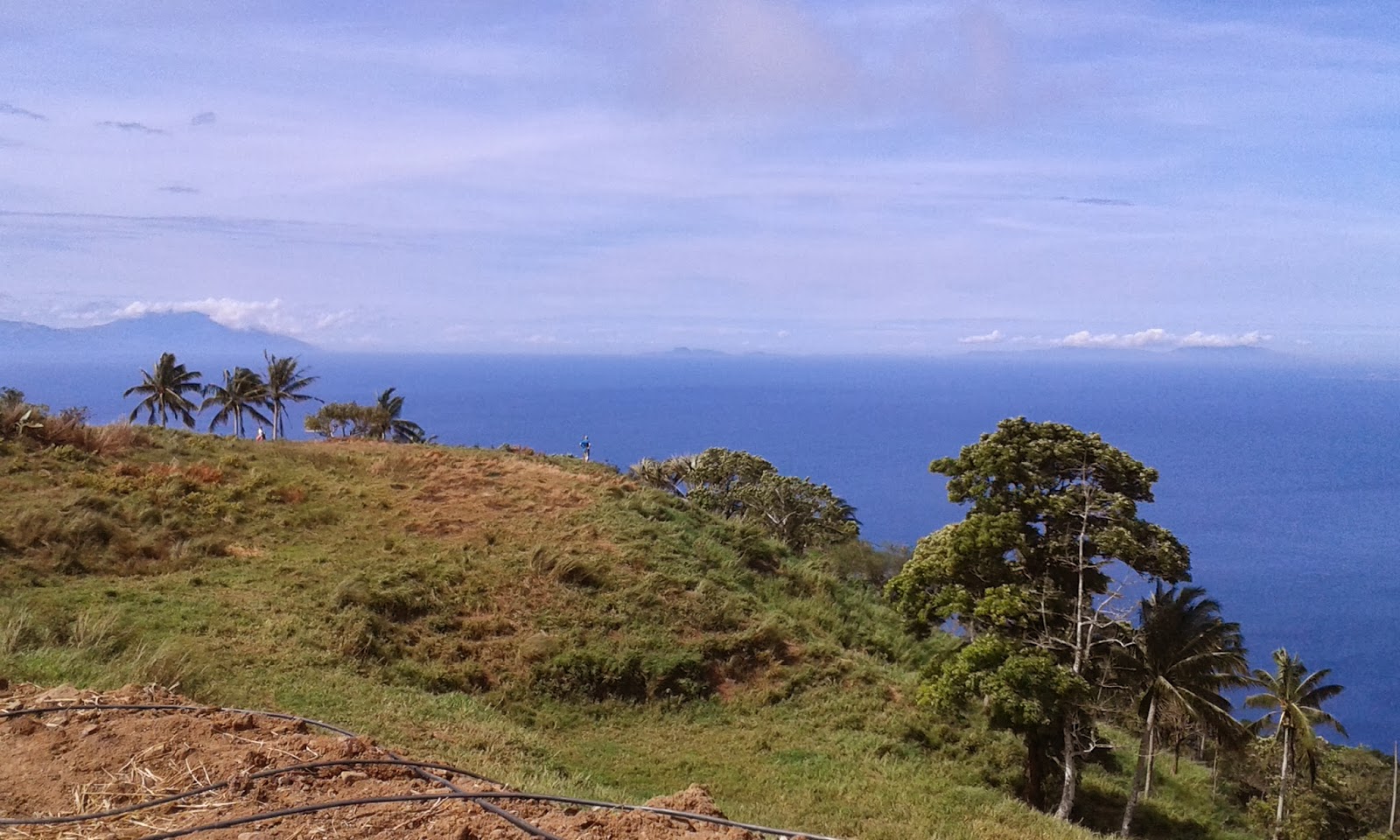
Mikor a legtetejére értünk akkor az egész Batangas megyére volt kilátásunk illetve a körülötte lévő tengerre is.
Sajnos a képet nem adják át amit élőben lehetett ott érezni !

Album picasa : https://picasaweb.google.com/108702034612298616088/2014Februar02TrekAtTheMtBulugodBaboy

2014, 2nd of February : While a part of our band, Thomas and Tibor, were diving for the last time this weekend, and Zoé, Joan and Martine, were having a rest in transat in front of the sea, we, Fanny, Jean, Christophe and I, decided to climb the "mountain" located just behind our hotel. Though is is called the Mt Gulugod Baboy (in Tagalog : the "pig's spine") it is really only a hill of 525 meters height.
A local guide came with us, to avoid us to get lost on the only one road that goes to the top !!
I have to confess that we sweat seriously during the 1 hour walk by passing on more or less climbing sections. We met local habitants during this short trip and a sympathic cow too.
When we finally reached the very top of the mountain, we were rewarding by a spendid view on almost the whole region of Batangas and the sea which surround this nice hill..... sorry Mountain !!
Unfortunatelly, my pictures are not really able to give back the real feeling that we had in front of this views !!

Picasa album : https://picasaweb.google.com/108702034612298616088/2014Februar02TrekAtTheMtBulugodBaboy

2 février 2014 : Pendant qu'une partie de la bande, Thomas et Tibor, les plus courageux, font de la plongée (6eme plongée en 2 jours), et qu'une autre partie de la bande, les plus fatiguées , Zoé, Joan et Martine (voilá, ce que c'est de travailler tous les jours jusqu'á pas d'heure !!) , nous (Fanny, Jean, Christophe et moi) avons décidé de nous rendre au sommet de la "montagne" située juste derrière notre hôtel. Bien que cette montagne porte le nom de Mont Gulugod Baboy (signifiant en Tagalog : «épine dorsale du cochon») c'est en fait une colline de 525 mètres de haut. 
Un guide local devait nous accompagner et juste avant d'entamer notre ascension, nous avons du nous enregistrer sur un fichier en indiquant nos noms et l'heure de notre départ . Nous supposons que si le soir venu, nous n'étions pas revenus, ils auraient envoyé les secours !
Je dois avouer que nous avons bien transpiré tout au long du chemin... le guide en premier !!! Il faisait chaud et des parties montaient assez fort. Nous avons rencontré des locaux qui vendaient des rafraichissements , mais pas d'eau. Et nous avons également croisé le chemin d'une vache bien sympathique.
Nous avons finalement atteint le sommet après 1 heure de marche. La vue était incroyable sur 360 degrés. D'un côté la région de Batangas et de l'autre la pointe de la presqu'île et la mer tout autour. Malheureusement, mes photos ne redonnent pas le sentiment que nous ressentions tout là-haut, au sommet de cette superbe colline... pardon,de cette superbe montagne !!!


Album photos sur Picasa : https://picasaweb.google.com/108702034612298616088/2014Februar02TrekAtTheMtBulugodBaboy


Majdnem fent voltunk mikor kb 10 bringással találkoztunk akik a másik felén a hegynek, Jeepney-vel felvitették magukat és ezen a felén próbáltak valahogy lemenni... a bringájukat tolva !!!
Nous étions presqu'en haut, quand nous avons rencontré une dizaine de bikers qui s'étaient fait déposé en haut par un Jeepney et qui "essayaient" de redescendre !!!!


jeudi 6 février 2014

ANILAO - Scuba Diving International certificate for Thomas


Fanny mondja hogy minden OK !
Fanny nous dit que tout est OK !


2014 január 30 (holnap iskola szünet, mert kínai újév) : Iskola után, Thomas, az követően hogy a SDI (Scuba Diving International) könyv két első fejezetét megtanulta, részt vett az első búvár tanfolyamon amely egy medencében történik. A helyszín a barátnőm Hélene-nél van, aki ő is leteszi a vizsgát. Ezen a tanfolyamon Thomas megtanulta, egyebek közt, az oxigén palack szerelését, a merülés előtti készülést, a víz alatti kommunikációt illetve a kötelező tudni valót az előtt hogy bárki is a nyílt vízben mehessen búvárkodni.
Majd, Thomas-nak meg kell még tanulnia a könyv többi részét és levizsgálni belőle, majd 4-6 nyílt vízi merülésen kell részt vennie, az oktatóval, hogy megkapja az első szint nemzetközi SDI bizonyítványt.

Picasa album a medencés oktatásról :
https://picasaweb.google.com/108702034612298616088/2014Januar30ThomasMedencesBuvarOraja

Tibor - Mabel - Thomas - Daniel
2014 január 31- február 01-02 : Így hétvégén  Anilao-ban (Batangas megyében) utaztunk, kanadai barátainkkal , arra a helyre ahol már voltunk mindannyian karácsony előtti hétvégén, pipa búvárkodni.
Tibor-nak már meg van a búvár igazolványa, és ebből adódóan ő is merült Thomas-val és az oktatóval.
Sikerült 14 méter és 20 méter közötti mélyre merülniük, 6 különböző merülőhelyre, Anilao 27 merülési helyszínei között.
Joan - Martine - Zoé - Jean
Egyik merülőhely úgy alakult ki hogy évekkel ezelőtt le zuhanyt egy helikopter a tengerben nem messze az Aquaventure szállás helyünktől, így a búvároknak adódott egy újabb merülő és felfedezési helyszín.
Amíg a fiúk merültek, mi bangká-val (fülöpi hajó fából) végig mentünk a parton és el is mentünk megmutattuk barátainknak a Sombrero Island szigetet ahol készült az idei karácsonyi üdvözlőlapunk.
Szombat délután, Zoé, Fanny és Martine, elmentek pipa búvárkodni. Fel kellett venniük a teljes neoprén ruhát mert elég "hideg" volt a víz, azaz csak 22-23 fok. Thomas és Tibor egy folytában merültek !!
 

Addig csapat többi tagja pihent, nyugágyban a tengerrel szemben  !!!
Vasárnap reggel , a kevésbé fáradt része a bandának fel sétált (felmászott) a 525 méter magas Gulugod Baboy "dombra", amely a szálló mögött van. De ez egy másik cikk témája lesz....

A Banda !!!! La Bande !!!! Balról-jobbra - De gauche à droite :
Mabel, Isa, Tibor, Jean, Joan, Zoé, Fanny, Martine, Daniel et Thomas
 Picasa album, Anilaóban töltött 3 napról :
https://picasaweb.google.com/108702034612298616088/2014Februar0102ThomasScubaDivingInternationalCertificate


2014, 30th of January (tomorrow it is day off in school because the Chinese new year) : After having learnt the SDI (Scuba Diving International) theory book first two chapters, Thomas attended on his first diving course which took place in the swimming pool of my friend Helene, who participated too. There, Thomas learnt how to mantle his diving equipment with the oxygen bottle, how to communicate under the water and all the obligatory things to know before diving in open water.   
After that, he has to learn the rest of the book, to pass exam on that and do 4 or 6 diving sessions with the instructor in open water to finally get the first level of the SDI certificate.

Picasa album of the course in the swimming pool :   
https://picasaweb.google.com/108702034612298616088/2014Januar30ThomasMedencesBuvarOraja 

2014, 31st of January- (Happy New year of the horse) 1st and 2nd of February : we decided to spend this long week end in Anilao (region of Batangas ) with our canadian friends. We have already been at this place to do snorkeling the week end just before the Christmas holidays. 
Tibor has already a diving certificate, and he was able to dive with Thomas and his instructor.
They went down between 14 and 20 meters depth, in 6 different sites among the 27 diving sites of Anilao. 
Several years ago, a helicopter crashed not far from the Aquaventure hotel where we stayed, and created a special diving site..
While the boys were diving, the rest of the group made a nice boat ride with a local bangka, along the coast, and we used the occasion to show our friends the Sombrero Island, where we made our family picture for the 2013 Christmas card.
Saturday afternoon, Zoé, Fanny and Martine, went to do snorkling. They had to wear neopren suit because the water was "cold", with only 22-23 degrees. The rest of the group had some deserved rest, installed in transat, on the terrace, in front of the sea !!!
On Sunday morning, the part of the band which was not as tired as the others, walked ( climbed) up to the top of the Mt Gulugod Baboy (+525 meters). But this will be the subject of a following article....

Picasa album about the 3 days in Anilao :   https://picasaweb.google.com/108702034612298616088/2014Februar0102ThomasScubaDivingInternationalCertificate

Jeudi 30 janvier 2014 : (demain c'est ferié, c'est le nouvel en chinois !!) Apres l'école, Thomas a eu son premier cours de plongée qui avait lieu dans la piscine de mon amie Hélène, qui elle aussi passait son brevet. Avant ce cours pratique, Thomas a du étudier les deux premiers chapites du manuel de SDI (Scuba Diving International). Grâce à ce cours en piscine, il a appris á s'équiper, á fixer la bonbonne d'oxygene, á l'ouvrir, à effectuer les vérifications de base, á se servir du détendeur, ensuite á communiquer sous l'eau, á récupérer un détendeur qu'il aurait perdu, et a appris les gestes obligatoires/essentiels á savoir avant de plongée en mer.
Ensuite, il devra apprendre le reste du manuel et pour enfin recevoir le certificat SDI, Thomas devra effectuer encore 4-6 plongées en mer avec son instructeur.


Album photos Picasa du cours en piscine :
https://picasaweb.google.com/108702034612298616088/2014Januar30ThomasMedencesBuvarOraja

janvier 2014 (Bonne Année du cheval !!!!!) - 1er et 2 février 2014 : Nous sommes donc tous partis passer un long week end de 3 jours, avec nos amis canadiens, à Anilao (province de Batangas). Nous étions déjà allés à Anilao faire du snorkling juste avant les vacances de Noel.
Tibor possède déjà un brevet de plongée et il a pu ainsi accompagner Thomas et son instructeur lors de leurs sorties en mer. 
Ils ont plongé à des profondeurs entre 14 et 20 mètres, sur 6 des 27 sites de plongées que compte ce paradis pour les plongeurs. Un des sites qu'ils ont visité était constitué d'un hélicoptère qui s'était écrasé plusieurs années auparavant non loin de l'hotel Aquaventure où nous logions, en créant ainsi un site de plongée assez particulier.
Sombrero Island
Pendant que les garçons plongeaient, le reste de la bande a fait un tour en bangka (bateau philippin en bois) le long des côtes et nous avons profité pour aller jusqu'à l'île Sombrero, qui nous avait servi de décor pour notre carte de voeux de 2013.
Zoé et Martine
Samedi après-midi, Zoé, Fanny et Martine sont allées faire du snorkeling pendant que les garçons plongeaient. Elles ont du mettre des combinaisons parce que l'eau était un peu fraiche en cette saison, autour de 22-23 degrés "seulement". Le reste de la bande se reposait tranquillement ; étendu sur des transats face à la mer !
Dimanche matin, pendant que Thomas, Tibor et Daniel (instructeur) faisaient une dernière plongée, la partie du groupe qui était la moins fatiguée, a grimpé ("gravi") la petite colline de 525 mètres de haut, appelée Mt Gulugod Baboy , située juste derrière l'hôtel. Mais cette aventure fera l'objet d'un prochain article ....


Album photos de ces 3 jours á Anilao :
https://picasaweb.google.com/108702034612298616088/2014Februar0102ThomasScubaDivingInternationalCertificate


Martine , championne du monde de snorkeling !!

mercredi 5 février 2014

Calamansi frissitő limonádé - Limonade raffraichissante à base de Calamansi

Ne haragudjatok a következő hír miatt : de vissza köszönt a meleg a Manilai térségben és pár napja már jól meleg van. Ilyenkor vágyik az ember frissítő italra , de ne legyek túl édes, és a víz már a füleinken jön ki.
Kész limonádé -
La limonade prête á être consommée !!!
Egy barátnőm meg ismertette velem a Calamansi (Kalamondin fa gyümölcse tagalogul)  limonádét, amit rögtön meg is szerettünk és amit azóta ipari mennyiségben gyártunk és fogyasztunk.
Házi készítményű !


A kalamondin bokor vagy kisebb fa, amely 3–6 méter magasra nő. A levélnyél szárnyszerű függelékei, illetve a fehér vagy lilás virágok jellemzőek rá. Gyümölcse kis, kerek zöldcitromra hasonlít, átmérője általában 25–35 mm, de néha 45 mm is lehet. A gyümölcs vékony, könnyen hámozható héja bőrszerű vagy szivacsos, húsa puha, szaftos gerezdekre osztott. (Wikipédia)


Don't be upset about the following news : warm is back here, in the region of Manila. After some weeks of weather around 20 degrees, we have had again some days with more than 30 degrees. So, we were looking for a fresh drink, not too sweet and not water, because we start to be fed up with water.
A friend of mine introduce me the Calamansi fruit ( fruit of the Calamondin tree, in Tagalog language), and showed me how to do limonade with it. We adopted this and since then, we are producing and consuming this drink in industrial volume. Home made limonade !!

The calamondin or calamansi, is a fruit tree in the family Rutaceae native Asia. Other English language common names include calamondingcalamandaringolden lime, "Philippine lime", Panama orangeChinese orange, acid orange. The plant is characterized by wing-like appendages on the leaf stalks and white or purplish flowers. Its fruit has either a spongy or leathery rind with a juicy pulp that is divided into sections. The fruit is indigenous and widely cultivated in the Philippines (Tagalogcalamansi or kalamansî). It is available year-round in the Philippines and is usually seen in its unripened green state. When left to ripen it turns a tangerine orange. (Wikipedia)

Fél kiló gyümölcsből -
Jus non filtré d'un demi kilo de fruit
Ne m'en voulez pas trop pour la nouvelle qui va suivre : cela fait plusieurs jours que la chaleur est revenue sur Manille. Apres plusieurs semaines d'un temps "frais" avoisinant les 20 degrés, cela fait quelques jours qu'il fait de nouveau chaud, avec plus de 30 degrés. Par un temps pareil, une boisson fraiche, légere en sucre est vraiment bienvenue. L'eau est la meilleure boisson, dit-on, mais croyez moi, elle commence á nous sortir de partout á force d'en boire des litres et des litres par jour. 
Il y a peu de temps, une amie m'a fait connaitre un fruit local, le Calamansi et m'a montré comment préparer de la limonade maison avec. Nous l'avons adopté et depuis nous fabriquons et consommons cette boisson par cruches entieres !! De la limonade maison !!!

Le calamondin ne se trouve pas à l’état sauvage, car il s’agit d’un hybride qui serait originaire d’un croisement entre le mandarinier et le kumquat. Apparu il y a quelques milliers d’années dans le sud de la chine, il migra très rapidement vers les Philippines, l’Indonésie et le Sud-Est asiatique. Maintenant cultivé un peu partout dans le monde comme plante décorative. Dans les pays au climat chaud, il est particulièrement populaire en Amérique du Sud et en Amérique centrale. 
Kifacsart gyümölcs - 1/2 kilo de fruits pressés
Calamondin vert : C’est la variété classique à feuillage vert petites et arrondies.  Les fleurs blanches et parfumées à l’extrémité des rameaux donnent des fruits ronds ressemblant à de petites mandarines. (http://agrumespassion.unblog.fr/calamondin/ )


jus filtré - 

kell majd víz és egy kis barna cukor -
de l'eau et un peu de sucre brun


samedi 25 janvier 2014

TAAL tó és vulkán - Taal Lake and Volcano- Le lac et le volcan TAAL


(lásd 2013 szeptember 01-én, már jártunk arra de köddel volt beborítva a tó és nem másztuk meg a vulkánt...)
A Taal-, vagy Bonbon-tó egy vulkánban található, de maga a Taal-vulkán is tóban helyezkedik el. A vulkán egy ősi, vízzel telt kalderából, a Föld egyik legnagyobb vulkanikus mélyedéséből emelkedik ki. Ez az újabb vulkán (Vulkán-sziget) is krátertavat rejt, melyben ismét csak egy vulkán és abban egy másik krátertó (Sárga-tó) helyezkedik el. A Vulkán-sziget produkálta a legtöbb aktivitást az újkorban, 1572 óta legalább 34-szer tört ki. A legutolsó nagyobb esemény 1977-ben zajlott, bár a kifejezetten veszélyes az 1965-ös tevékenység volt, mikor hatalmas porfelhő szállt fel mintegy 20 km magasba a légkörben, a kilövellés lökéshulláma a 4 km-re eső pálmafákat is elpusztította. 1754-ben a láva négy települést öntött el, 1911-ben pedig 1344 ember életét követelte a kitörés. A vulkán mostanában ismét nyugalmi időszakban van, 1999 februárja óta az egyik ösvény közelében rendszeressé vált a 20 méter magas forró víz- és sároszlopot fröcskölő gejzírek tevékenysége.
A kráter és a tó látványa egy magasabb kilátóhelyről élvezhető leginkább, például a nagy kürtő északi pereméről, melyet Tagaytay-gerincnek hívnak. A tóban a világ egyetlen édesvízi szardíniája és egy mérges tengeri kigyófaj él, amely édesvízben szaporodik.

Két napos kirándulás Tagaytay-ban, kanadai barátokkal, Montreal-ból :
- ebéd a Hotel Vistában, gyönyörű kilátóval
- bárkával a tavon át a vulkán partjáig
- lovak hátán 4 km-t a vulkán széléig
- csoportos kép ( majd egy koreai csoport akart velünk fényképezkedni)
- másnap : méhecske farm látogatás
- "hal" pedikűr az egész csapatnak ( kivéve Zoé, aki nem akart)
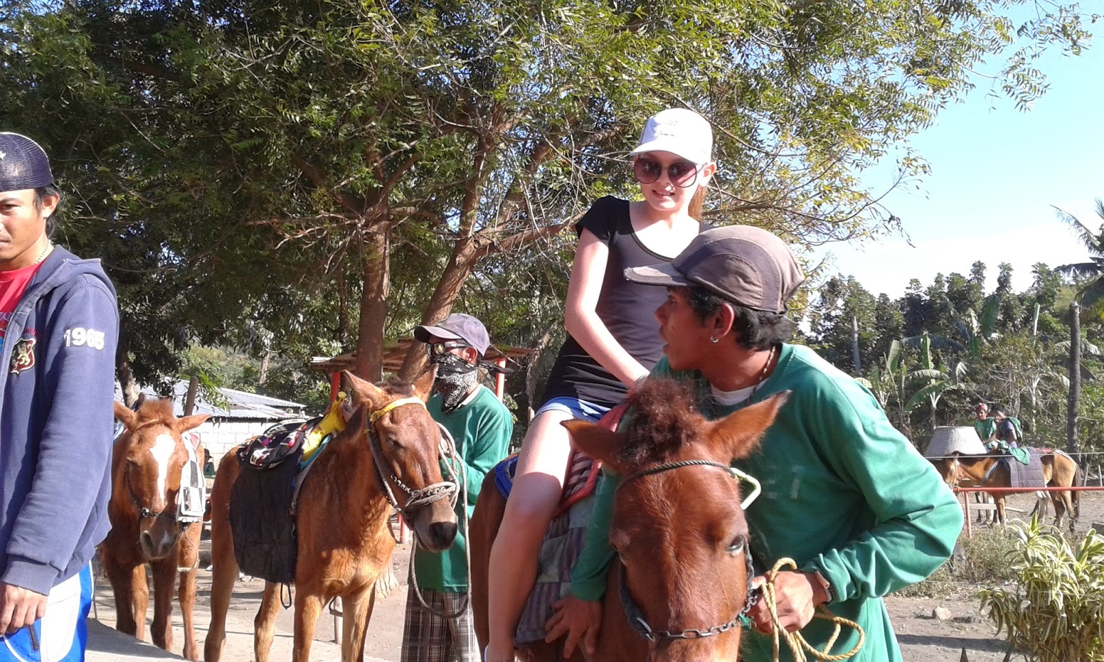
- kis lovaglás a lányoknak
- majd hazafelé , az út szélén, főtt kukoricát lehetett venni

Lásd az albumot : 
https://picasaweb.google.com/108702034612298616088/2014Januar2526VisitToTAGAYGAYWithFriends
----------------------------------------------------

(see article writen and posted on 2013, September 1st, we have already been there but the lake was covered by a thick fog.....)

Vulcan Point in the Philippines is the world's largest island within a lake (Main Crater Lake) that is situated on an island (Volcano Island, aka Taal Island) located in a lake (Lake Taal) within an island (Luzon). It also happens to be one of the cones of the active Taal Volcano, so Vulcan Point is also the world’s largest volcano in a lake (Main Crater Lake) on a volcano (Taal Volcano). And Main Crater Lake also happens to be the largest lake on an island (Volcano Island) in a lake (Lake Taal) on an island (Luzon). Got that?
Viewed from Tagaytay Ridge, Taal Volcano and Lake presents one of the most picturesque and attractive views in the Philippines. It is located about 50 km (31 miles) from the capital of the country, the city of Manila. The volcano had several violent eruptions in the past causing loss of life in the island and the populated areas surrounding the lake, with the death toll estimated at around 5,000 to 6,000. Because of its proximity to populated areas and its eruptive history, the volcano was designated a Decade Volcano, worthy of close study to prevent future natural disasters. It is one of the active volcanoes in the Philippines and part of the Pacific ring of fire...The 1911 eruption drastically changed the floor of the main crater. Before the eruption, the crater was above sea level. Vulcan Point was the remnant of the old crater floor that is surrounded by a lake about 2 kilometers (2,000 m) across, called Main Crater Lake. Vulcan Point is cited in the Philippines as the world's largest island within a lake on an island within a lake on an island, i.e., Vulcan Point within Crater Lake, on Taal Island within Lake Taal, on the island of Luzon


Two days excusion in Tagaytay with Canadian friends from Montreal :
- lunch on Saturday at the Hotel Vista and its wonderful view on the Lake
- Ride across the lake with bangka boat to reach the volcano
- ride on horse the 4 km till the top of the volcano
- group picture ( then a Korean group joined us for the picture)
- the following day : visit in a bee farm
- "fish" pedicur for the whole group, except Zoé
- horse riding for Fanny and Zoé
- finally we saw a corn cooked saler at the side of the road back

See album                                 : 
https://picasaweb.google.com/108702034612298616088/2014Januar2526VisitToTAGAYGAYWithFriends
---------------------------------------

(voir article du 1er septembre 2013, nous sommes déjá allés dans ce coin mais le lac était recouvert d'un épais brouillard ......)

À une soixantaine de kilomètres au sud de la capitale des Philippines, Manille, le Taal se présente sous la forme d’un complexe volcanique composé d'une vaste caldera de 15 Km par 20, occupée par le lac Taal. C'est au centre du lac, sur l'île de Vulcano Island, qu'ont été répertoriées les éruptions historiques. Vulcano Island est constituée d'un cône dont le cratère sommital est, lui aussi, empli par un lac. La position du cône actif est à l'origine des principaux risques pour les populations riveraines. En effet, les éruptions les plus puissantes sont à même d'engendrer des tsunamis dévastateurs (1330 victimes en 1911). D'un point de vue plus scientifique, le Taal fut le site où, pour la première fois en 1965, fut décrit le phénomène volcanique nommé ""déferlante basale"", qui se présente sous la forme d'un nuage annulaire se développant à la base d'un panache phréatomagmatique, et constitué d'un mélange de cendres, lapilli et gaz en suspension dans de la vapeur d'eau


Une excursion de deux jours á Tagaytay avec des amis canadiens de Montréal : 
- brunch avec spectacle philippin au resto de l'Hotel Vista et sa vue magnifique sur le lac et le volcan
- traversée du lac en Bangka pour rejoindre le volcan
- ballade de 4 km á dos de chevaux pour rejoindre le sommet
- photo de groupe ( avec un groupe de coréens qui voulaient absolument prendre une photo avec nous)
- jour suivant : visite d'une ferme d'abeilles 
- pédicure faite par des poissons "docteur" pour tout le groups , sauf Zoé
- tour á cheval pour Zoé et Fanny
- vendeur de mais cuit, au bord de la route du retour

Voir l'album : 
https://picasaweb.google.com/108702034612298616088/2014Januar2526VisitToTAGAYGAYWithFriends